Maps
A map in locust and grasshopper management is a visual representation of spatial relationships between places, features, or phenomena, such as outbreak locations, monitoring sites, treatment areas, or pest distribution patterns, usually drawn to scale on a flat surface to communicate geographic information for surveillance, control planning, and resource allocation.
If you are interested in maps check out geospatial dashboards, and remote sensing tools. If you are looking for historical maps of grasshopper surveys and outbreaks in the US see the USDA Rangeland Portal archives.
Highlighted maps



Search the full list of maps
| Name | Year published | Resource link | Author |
|---|---|---|---|
| Distribution Atlas for Grasshoppers and the Mormon Cricket in Wyoming | University of Wyoming | ||
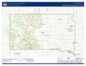
| South Dakota grasshopper management surveys | |||
| U.S. Grasshopper Forecast Maps | United States Department of Agriculture, Agricultural Research Services | ||
| USDA APHIS grasshopper forecasting and survey map collection | 1930s | APHIS Plant Protection and Quarantine, United States Department of Agriculture | |
| Wyoming Grasshopper Maps | University of Wyoming |
See also: Geospatial dashboard , Remote sensing resources